
Mullaghanoe [Mullach an O]
Good walks are even better shared.
Overview
Mullaghanoe [Mullach an O]
Introduction
Nestled in the heart of the Irish Midlands, Mullaghanoe, also known as Mullach an O, stands as a proud Marilyn with an elevation of 650 meters. This gem is a must-visit for hikers looking for a blend of stunning views, intriguing geology, and a touch of Irish folklore.
Geology
The mountain's primary geological composition is sandstone with limestone outcrops. You might even stumble upon fossils, a reminder of the ancient sea that once covered this region. The layers of rock tell a story of time, erosion, and geological upheaval.
Routes
The most popular route, The Mullaghanoe Loop, offers a moderate challenge with a distance of 6.5 km. Starting in Ballaghaderreen, the loop provides a delightful experience, wrapping around the mountain with breathtaking views. Expect to take about 2.5 hours to complete, perfect for an afternoon jaunt.
Summit Features
At the summit, you’ll find a robust stone cairn standing proudly alongside a trig point. This is where you’ll want to pause for your well-deserved summit selfie—don’t forget to post it to prove you made it!
Terrain
The terrain varies from grassy slopes to rocky outcrops, with a few boggy spots thrown in for good measure. It’s not known for being ‘flat as a pancake’, so make sure to wear sturdy boots.
Views
Mullaghanoe boasts stunning panoramic views. On a clear day, the majesty of the Slieve Bloom Mountains and rolling hills will leave you awestruck. Spring and autumn are particularly magical times to visit, with the landscape bursting with colours.
Hazards
A note of caution: the weather can change faster than a squirrel on a caffeine rush. Be prepared for a range of conditions, and keep an eye out for slippery trails, especially in boggy areas.
Nearby Summits
For the ambitious, nearby summits like the Ballyhoura Mountains and Slieve Bloom Mountains offer further exploration possibilities and can make for a fabulous multi-day hiking experience.
Access
Accessing Mullaghanoe is quite straightforward. There’s parking available in Ballaghaderreen, which is a lovely little town with all the amenities you might need before or after your hike.
Facilities
Once you’ve conquered the mountain, be sure to stop by the local café in Ballaghaderreen for a well-earned cuppa and maybe a slice of cake.
History
The name Mullaghanoe translates to 'the summit of the river', which hints at its significance as a geographical marker. The area is rich in folklore, with tales that intertwine the ancient and the mystical.
In summary, Mullaghanoe is not just a mountain; it's a slice of Irish culture wrapped in natural beauty. Whether you're trekking solo or with friends, it promises an adventure worth every step.
Happy hiking!
Explore routes near Mullaghanoe [Mullach an O]
Public walks starting within 80 km of this hill. Nearby does not mean a route reaches the summit; check its map and access before setting out.
Route planning notes
These notes describe possible approaches, not verified navigable routes or permission to cross land. Check current paths, local access rules and conditions before setting out.
The Mullaghanoe Loop
A scenic loop trail that circumnavigates the mountain, starting from the nearby village of Ballaghaderreen.
Make a day of it, together
Find someone to share the walk with, or organise a day out along a route you like.
Hill facts and local notes
Classifications
Elevation
234m
768 ft
Prominence
151m
Coordinates
53.9383, -8.7255
M524990
OS Map
32
At the Summit
The summit features a large stone cairn and a trig point, perfect for that all-important summit selfie.
Terrain & Geology
Mullaghanoe is primarily composed of sandstone with some limestone outcrops, offering a stunning geological perspective of the surrounding area. Its geological features reveal the ancient processes that shaped this land.
Views & Scenery
From the summit, one can see the majestic Slieve Bloom Mountains and the rolling hills of the Irish countryside.
History & Heritage
Name Origin
The name 'Mullaghanoe' is derived from the Irish 'Mullach an Eo', meaning 'the summit of the river'.
Historical Significance
This mountain has historical significance as a site for local folklore and is often mentioned in stories of ancient warriors and mysticism.
Getting There & Facilities
Check current local access restrictions, parking rules and transport timetables before travelling. These notes do not confirm public access to the summit.
Parking
There is a small car park near the trailhead in Ballaghaderreen. It can accommodate a handful of cars.
Public Transport
Public transport is limited, but local buses do operate from nearby towns. Carpooling is highly recommended for a bit of fun!
Nearby Facilities
There's a delightful café in Ballaghaderreen offering refreshments and a good ol' cup of tea after your hike.
Safety Information
Known Hazards
- Be wary of changing weather conditions; the Irish weather can be as unpredictable as a cat on a hot tin roof.
- Boggy sections can be slippery, so watch your step.
General Safety Tips
- Check weather conditions before setting out
- Carry appropriate clothing and equipment
- Let someone know your planned route
- Take a map, compass, and GPS device
- Carry emergency supplies: food, water, first aid kit, torch
Hills
Some common questions about the hills answered
Are there group walks up Mullaghanoe [Mullach an O]?
Many walkers use Walkmates to join or organise walks with others. You can check for group walks around Mullaghanoe [Mullach an O] through the maps
Are there other walkers around Mullaghanoe [Mullach an O]?
Activity varies by location and time, but Walkmates lets you see whether others have shared walks or shown interest in this area. Find other people through the walking friends search walking friends for Mullaghanoe [Mullach an O] search or of course create your own walk for Mullaghanoe [Mullach an O]
Can I organise a walk to Mullaghanoe [Mullach an O]?
Yes. If there aren’t any walks listed already, you can create a walk and make it available for others to join.
If you're signed up to Walkmates, you can create a walk to Mullaghanoe [Mullach an O].
How do I find a walk up this hill?
There are often multiple ways to walk this hill, depending on experience and route preference. Walkmates helps you explore walks and routes that others have shared.
Can I suggest a new route up Mullaghanoe [Mullach an O]?
Yes. You can suggest or create routes to share with others. Walkmates focuses on the social side of walking, so routes are used to help people organise walks and explore areas together, rather than as detailed navigation tools or route libraries.
Other uses really appreciate knowledgeable walkers sharing their routes. Share your favourite route to Mullaghanoe [Mullach an O] here
The is an error or something incorrect about this hill. How do I let you know?
We always strive to keep the information on Walkmates as accurate as possible. If you find an error, please let us know through the contact form and we'll aim to correct it as quickly as possible
Community Discussion
Comments
Location
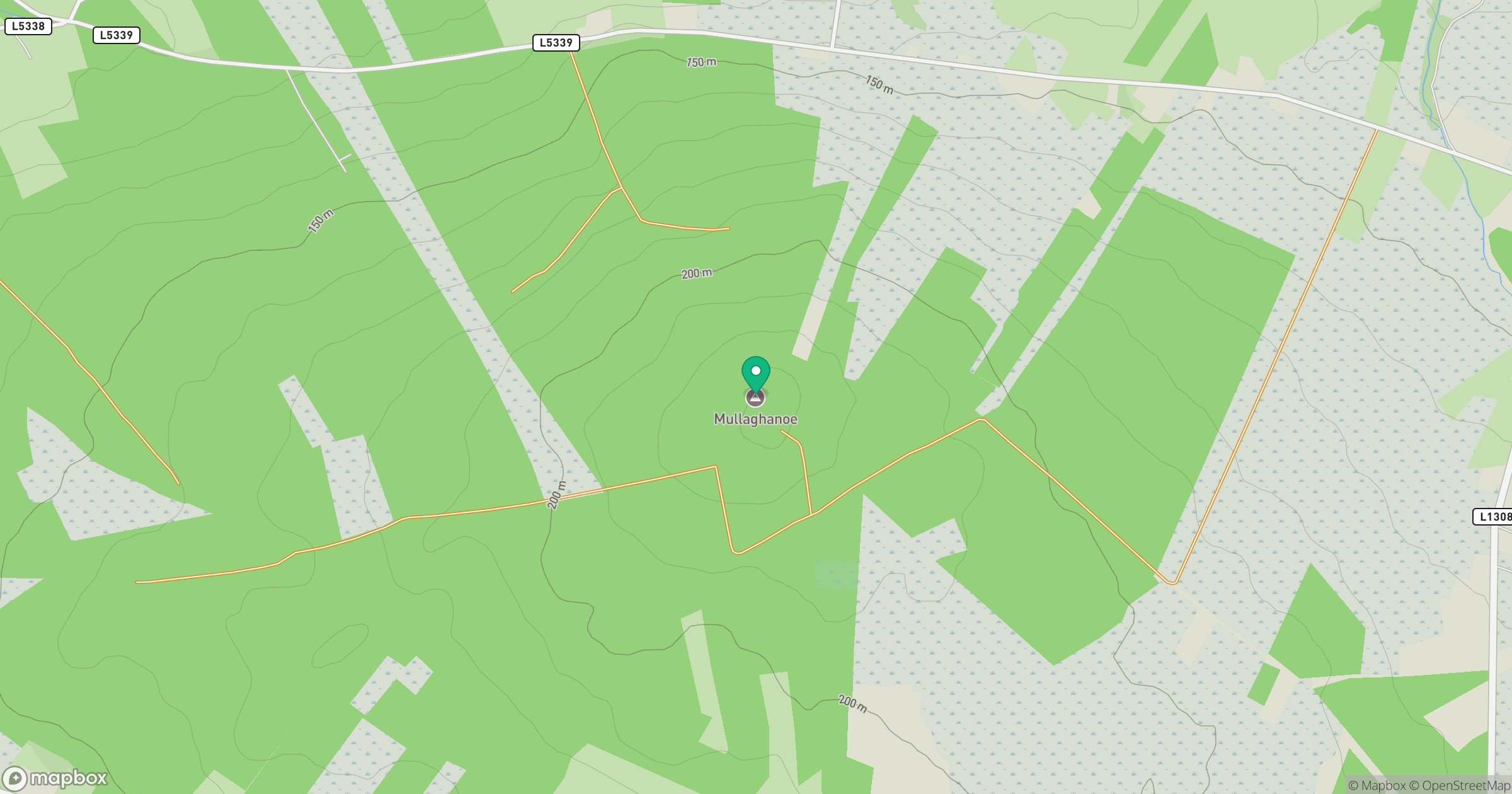
Grid reference: M524990
View on OpenStreetMapOpens a map in a new tab, centred on the hill.
Hills within 30 km
Straight-line distance, not a walking route or confirmation of access.
No comments yet. Be the first.